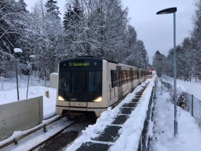
UPDATED: Public transport was recommended as the best alternative where available on Wednesday: Exceptionally hazardous driving conditions caused by rain freezing on roads made them “slippery as soap,” while pedestrians were also urged to be careful on slick sidewalks.
State meteorologists issued a new batch of warnings on Tuesday that were reinforced on Wednesday, as this winter’s weather with changing temperatures continues to pose challenges. The snow that fell in recent days, especially in the southeast, turned into rain that can instantly freeze into slippery ice that’s sometimes invisible on the ground. The ice can form too quickly for maintenance crews to offset it with salt, sand or gravel.
Storms in the mountains were prompting additional warnings on Wednesday. “It will be difficult to drive on mountain passes,” state meteorologist Per Egil Haga told state broadcaster NRK Wednesday morning. Roads may close at short notice, with Haga warning of a storm center near Scotland that was moving towards Norway. “It’s going to be very bad weather” in the mountains Wednesday night, Haga said.
A double-decker bus skidded off the E18 highway near the Swedish border at Ørje during the night and tipped over on its side, while police were out helping to direct traffic in Drammen on slippery streets Wednesday morning.
NRK was already reporting difficult driving conditions around the Oslo area Tuesday afternoon, and several accidents around Gjelleråsen and Romerike. The weather service yr.no was also reporting hazardous conditions at low elevations, because of milder weather and the danger of rain freezing on contact with the ground. At higher elevations and in the mountains, the hazards were a result of strong winds and blizzard-like conditions.
“The cold air very often remains lying low in valleys after a cold snap,” meteorologist Kristen Gislefoss said. “It can well be that temperatures will rise first at higher elevations, and then down in the lowlands.” He said that’s what can make driving and also walking on streets and sidewalks Tuesday evening and Wednesday difficult. “Everyone needs to be very observant and careful,” he said.
The state highway department (Statens vegvesen) posted warnings for Hedmark and Oppland through Wednesday because of the looming arrival of higher temperatures. Warnings were also up for Buskerud and the Agder counties and most of Western Norway. “Show respect for the weather and lower your speed,” the department advised at midday on Tuesday. They offered the advice on Wednesday, as meteorologists predicted ongoing difficult conditions well in Thursday.
Bridges were also expected to be especially slick. Pedestrians were also being urged to be careful on sidewalks that can turn instantly icy before maintenance crews have a chance to salt or strew gravel over them. Brodder (spikes that can be attached to boots) or footwear with built-in spikes were recommended.
newsinenglish.no/Nina Berglund